



9. Bangladeshfloods by rgamesby

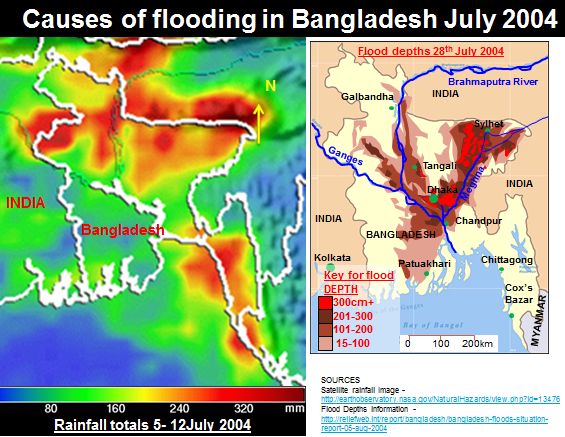
At the time of the July 2004 floods 40% of the capital, Dhaka
was under water. 600 deaths were reported and 30million people were
homeless.
100,000 people alone in Dhaka suffered from diarrhoea
from the flood waters.
Bridges were destroyed, the death toll rose to 750 and the
airport and major roads were flooded.
This hampered relief efforts.
The damage to schools and hospitals was
estimated at $7billion.
Rural areas also suffered, the rice crop was
devastated as were important cash crops such as jute and sugar.
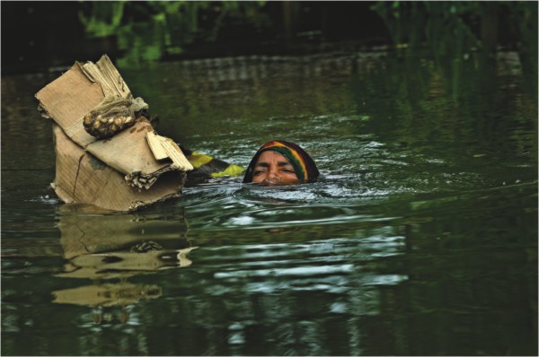

Management and aid
Within Bangladesh food supplies, medicines, clothing and
blankets were distributed.
Local people began to rebuild their homes but
disease from contaminated and often stagnant flood water remained a
threat.
The United Nations launched an appeal to raise
$74million, but had received only 20% of this by September.
Water Aid helped by bringing water purification
tablets and education campaigns.
In the long term a Flood Action Plan is in place in Bangladesh, but the embankments which are supposed to protect against flooding have not always been successful. Flood warnings and provision of food and shelter has had a more positive impact.
Complete the annotation exercise below
Click here for full screen version
Click here for a Large version of the map